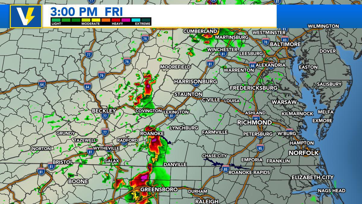
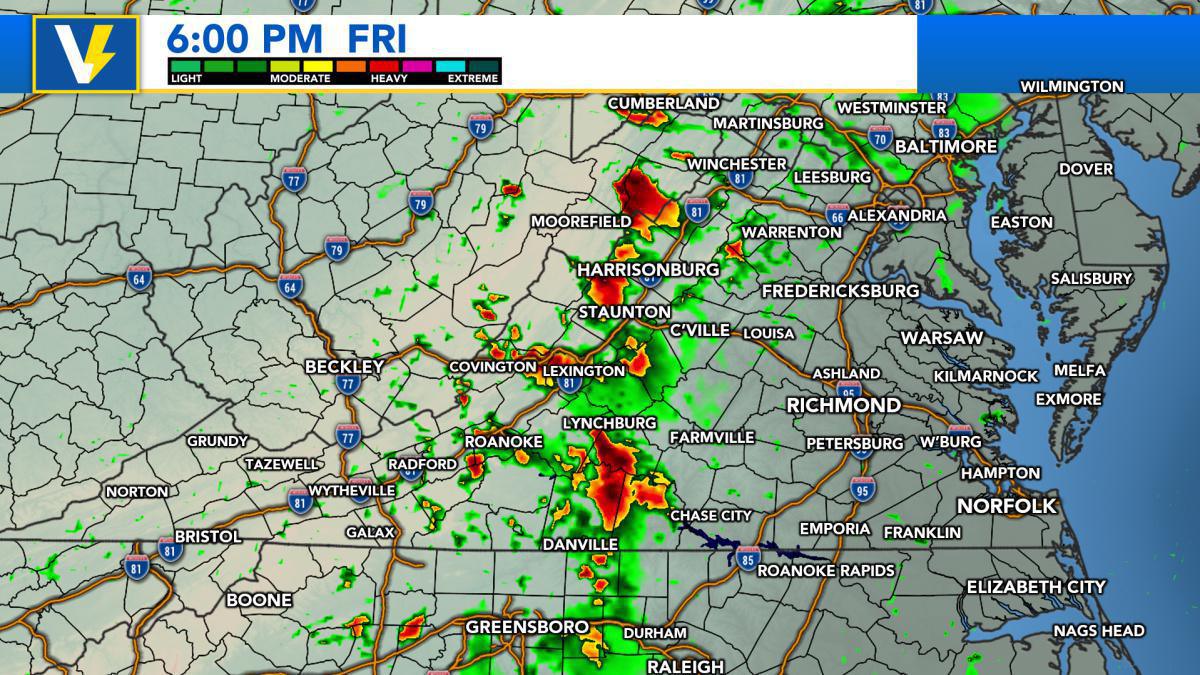
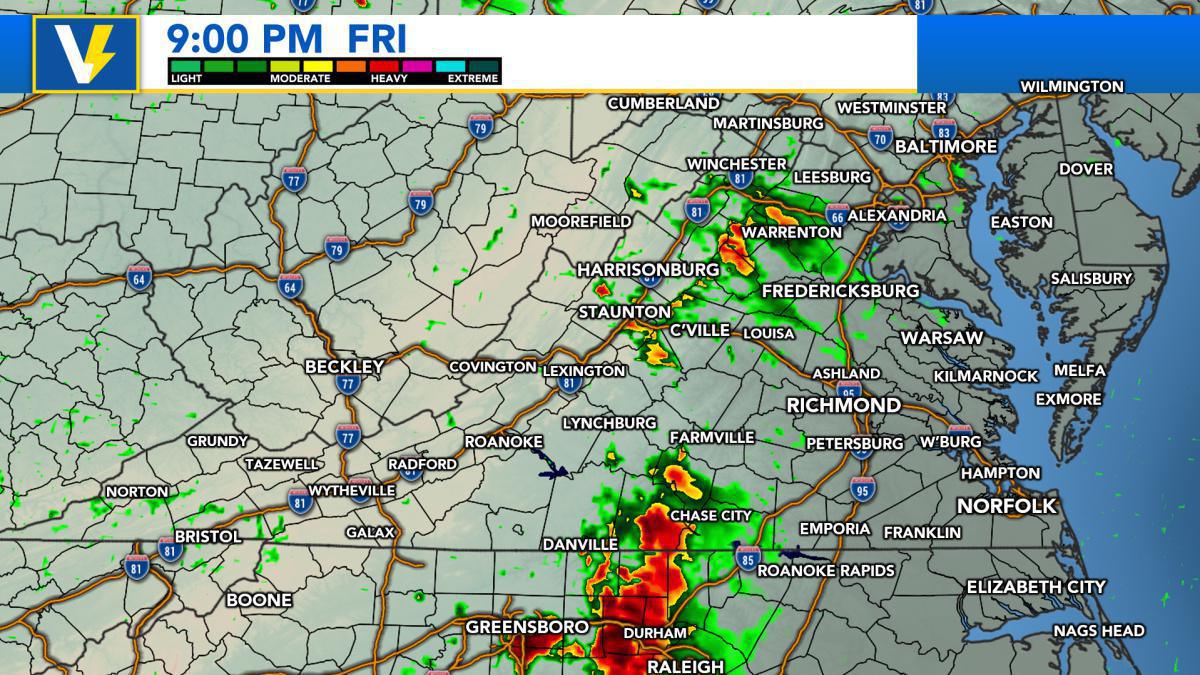
Models disagree on the placement of severe weather.
The Storm Prediction Center has issued a SLIGHT RISK for severe weather along and WEST of Interstate 77 in Southwestern Virginia. A MARGINAL RISK has been issued for counties WEST of Interstate 95, which includes all of the Virginia Piedmont, Shenandoah Valley, New River and Roanoke Valleys.
Models are "split" on exactly where severe weather will take place Friday afternoon. The HRRR model has severe weather across Southwestern Virginia, while the NAM model has severe weather across the New River and Roanoke Valleys. Regardless, there is the threat for any thunderstorm to produce damaging winds, hail, frequent lightning, heavy rainfall, and an isolated tornado.
By 6:00 p.m. Friday, most models suggest a line of thunderstorms along the Blue Ridge Mountains, moving into the Virginia Piedmont by Friday evening. If thunderstorms develop earlier than later, there is a chance that these thunderstorms could make it across Interstate 95. However, later development would suggest these storms weaken before reaching the corridor.
Remember to move indoors when you hear thunder. Stay away from windows and unplug electrical appliances. We will have another update on this potential severe weather event late tonight and again Friday morning on the app and on our Facebook page.


